 |
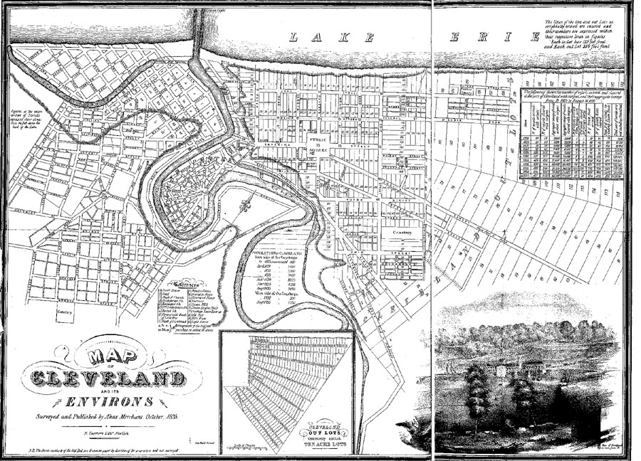
| Figure 3 - Ahaz Merchant's 1835 map of Cleveland, the first published map of the city. Note the Two-Acre Lots between the river and the present alignment of East 14th Street (approximately where the prominent crease is on this image), beyond which to the east is the range of Twenty-Acre Lots (also shown in the inset, bottom center). West of the river are the allotments of Ohio City, Cleveland's major rival of the 1830s, which rivalry lead to the "Bridge War" at the Columbus Street Bridge (inset drawing). This map is a clear indication of the economic forces wrestling for control of the local economy. (Map is Figure 14 in Chapman's Cleveland: Village to Metropolis. 1964. Page 40-41) |