 |
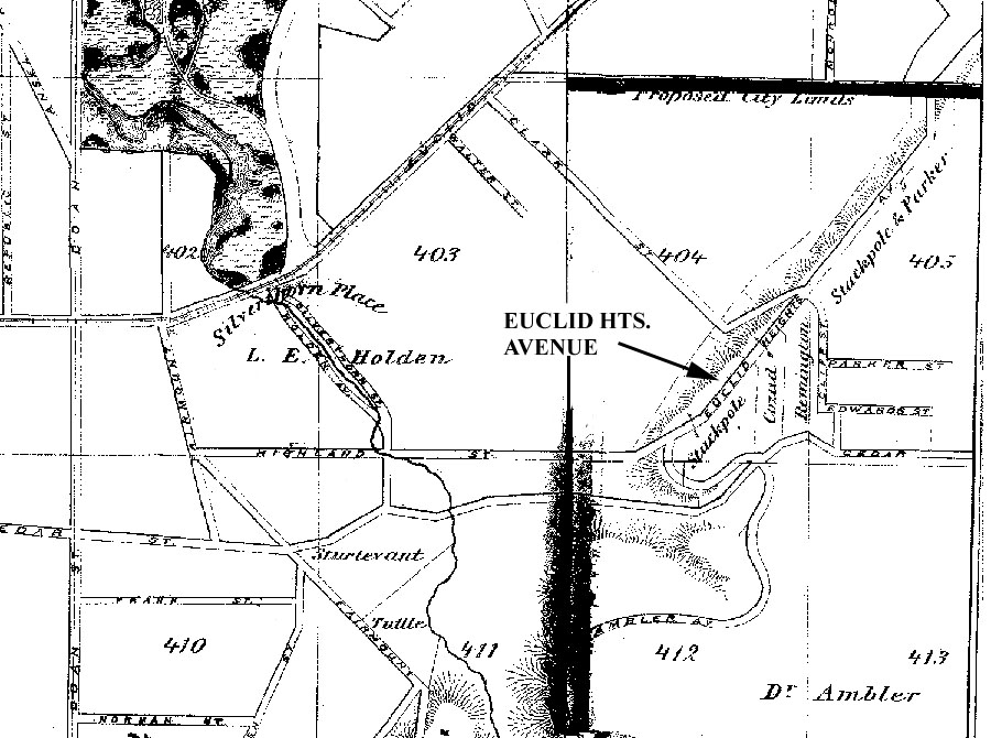
| Figure 7 - Detail from one of two maps drawn by Otto Dercum in the 1870s, showing the location of a proposed "Euclid Heights Avenue," to run approximately where Overlook Road is today. No other cartographer has portrayed such a road existing there. As shown, it would have ascended the ridge just north of Cedar Glenn, veered northerly to parallel the ridge, crossing Clark Street at its intersection with Cliff Street, and terminated at Mayfield Road. |