 |
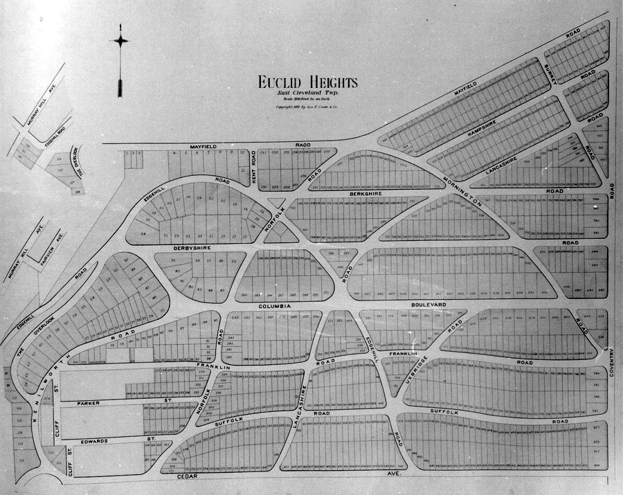
| Figure 8 - The Euclid Heights Allotment of 1892, as published in Cram's atlas of that year. The recorded plat omits most of the area south of Columbia Boulevard, and east of the blank area representing the allotments of JJ Low and of Stackpole and Parker, in the lower left corner, so this is the only complete view of what was intended. This is layer 3 of the palimpsest. |