 |
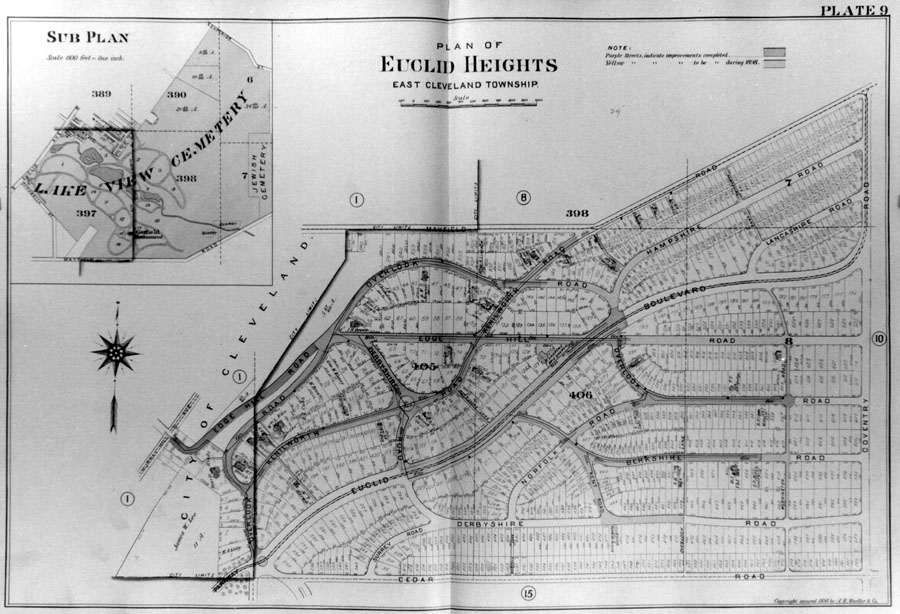
| Figure 12 - The Euclid Heights Allotment of 1896, as published in Mueller's atlas of 1898. The allotments of the 1870s have been eliminated here and the installation of Euclid Heights Boulevard has altered the configuration of streets. The recorded plat omits most of the area flanking Derbyshire Road, just north of Cedar Road, which is where the Euclid Club golf course was installed. Note that the published version of this map has color coding, showing the completion dates of different segments of the internal street pattern. This is layer 4 of the Euclid Heights palimpsest. |