|
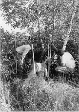
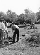
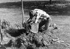
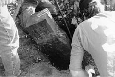
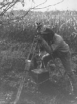
Pennsylvania-Ohio Boundary Retracement Survey The border between Pennsylvania and Ohio is particularly important in the history of the Western Reserve as it was used as the base line, or foundation, of all the surveys of the Reserve, in 1796. This border, called the "Ellicott Line" after the original surveyor Andrew Ellicott, was originally surveyed and marked in 1786. From 1878-1882 the two states formed a boundary commission to jointly re-survey and add additional monuments, approximately one every mile over the 92-mile long line. Now, for the past several years, a joint team of volunteers from the professional surveyors' organizations in Ohio and Pennsylvania are re-tracing the 1880s survey, locating the original underground markers and restoring the surface reference monuments to their proper position along the boundary. In the process, some of the surviving Ellicott boundary markers have also been located. Here are some photos I (Bill Barrow) took in 1994 when I joined a party of surveyors for an afternoon. I discovered that I am not, in fact, immune to poison ivy, but that's a story for another web page. (These captions have been edited to clarify some ambiguities in my original wording that led some professional concerns about what was being done.)
The retracement survey continues, using Global Positioning System (GPS) technology to accurately establish geodetic positions on each of the monuments along the Ohio-Pennsylvania border. For further information, you can contact Dean Ringle at dringle@fceo.co.franklin.oh.us. Last updated June 21, 2003
|