| Figure |
Caption |
Section |
300 dpi |
150 dpi |
| 1. |
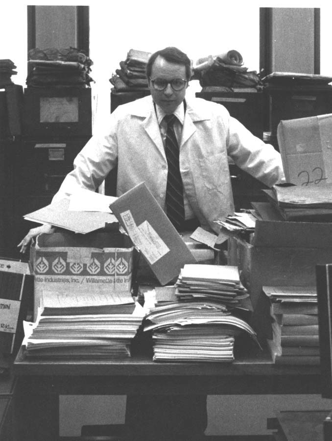
Walter Leedy, an Associate Professor of Art at Cleveland State University,. . . . |
Author |
gamut39.jpg |
gamut39t.jpg |
| 2. |
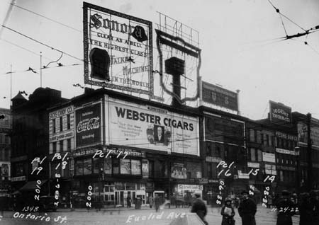
The southwest corner of Euclid Avenue and Ontario Street as it appeared in 1922, before demolition for new construction. The site is now occupied by the Higbee Company, part of the Van Sweringens' efforts to create a high-density development. The writing on the photograph indicates land parcels that the Van Sweringen interests were acquiring. Photo: Gerald Adams collection. |
1. |
gamut40.jpg |
gamut40t.jpg |
| 3. |
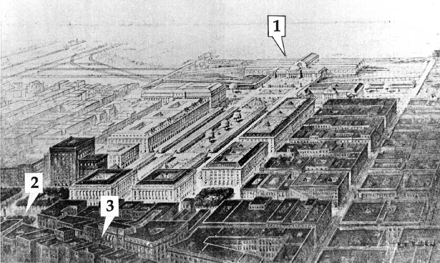
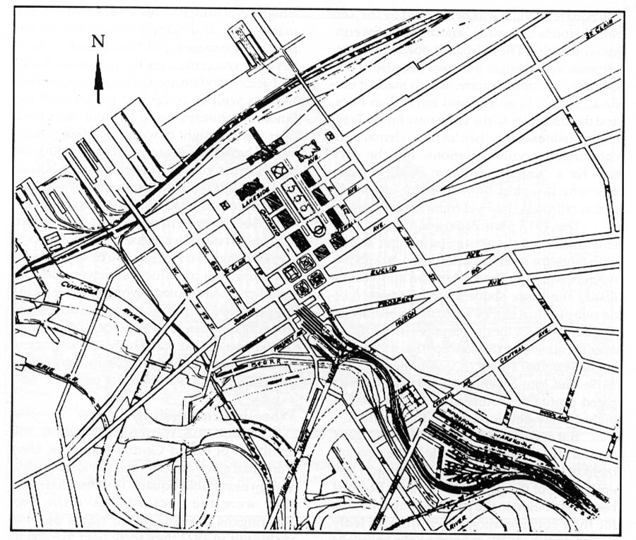
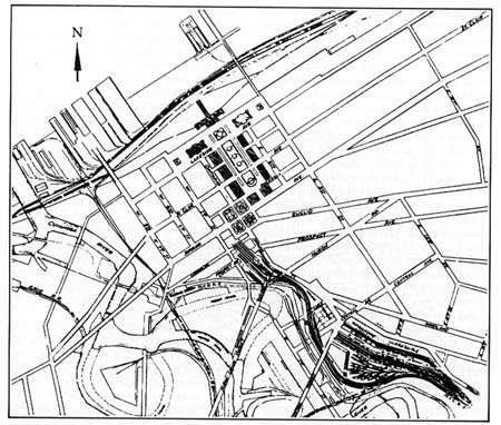
The Burnham Commission's plan for the Cleveland Mall, including buildings projected for the near and distant future. From 1903 until 1919, the anticipated site for the new Union Station (1) was to be at the end of the Mall near the lake. Recognizable in this rendering are Public Square (2) and Euclid Avenue (3) Drawing from the Commission Report, reproduced in Charles Moore, Daniel H. Burnham (1921) |
2. |
gamut41.jpg |
gamut41t.jpg |
| 4. |
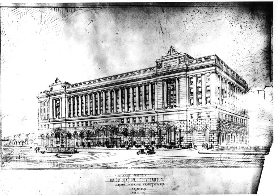
The Union Station that never was; one of several proposed schemes done between 1915 and 1917 for the new terminal to be located on the lakeside end of the Mall. Drawing by the architectural firm of Graham, Anderson, Probst and White. Gerald Adams collection. |
2. |
gamut42.jpg |
gamut42t.jpg |
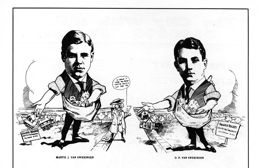
| 5. |
Oris Paxton (b. 1879) and Mantis James (b. 1881) VAN SWERINGEN came from a farming area near Wooster, Ohio. . . . |
Sidebar |
gamut43.gif |
gamut43t.gif |
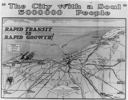
| 6. |
This prospectus illustrates how other entrepreneurs jumped on the Van Sweringens' band wagon, hoping for magnificent profits through real estate sales and speculation. Pamphlet, author's collection. |
3. |
gamut44.jpg |
gamut44t.jpg |
| 7. |
Map from Engineer's Report of March, 1917, showing the track layout for the stub-end station planned at that time for the southwest quadrant of Public Square. Plans were still going ahead for a Union Station on the lakeside end of the Mall. Gerald Adams collection. |
3. |
gamut45.jpg |
gamut45t.jpg |
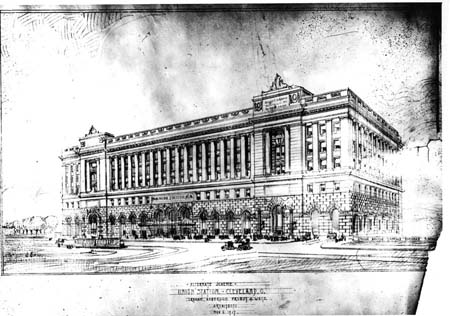
| 8. |
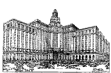
Design for the Union Station on Public Square, as of August, 1918. The Hotel Cleveland (right wing),already built, was to be a subordinate element in the overall design. Reproduced from Engineer's Report, 1919, CSU Archives. |
4. |
gamut47.gif |
gamut47t.gif |
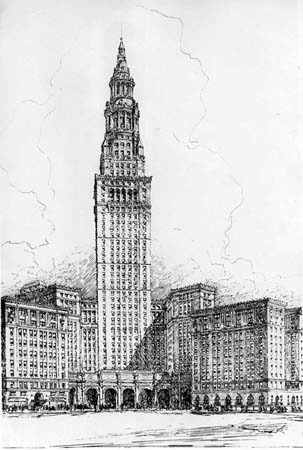
| 9. |
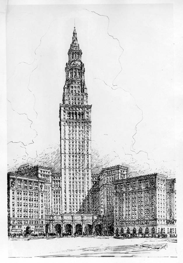
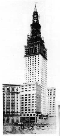
Terminal Tower, architect's rendering, early 1925. Ornamental figures along portico were later eliminated because of expense. CSU Archives. |
9. |
gamut53.jpg |
gamut53t.jpg |
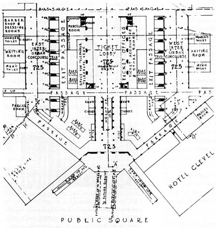
| 10. |
Proposed plan at station level, 1921. One in a series of proposals based on a main, single ramp which led down to station area. CSU Archives |
9. |
gamut54a.jpg |
gamut54at.jpg |
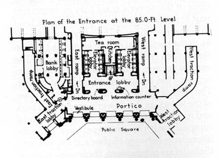
| 11. |
Double ramp plan of entrance portico at street level, as actually built, 1930. Comparison with the earlier plan (left) shows shift in visual emphasis from station to office tower. Drawing reproduced from Railway Age. |
9. |
gamut54b.jpg |
gamut54bt.jpg |
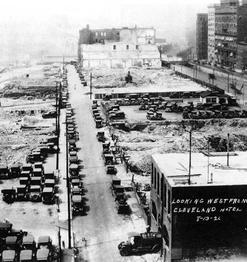
| 12. |
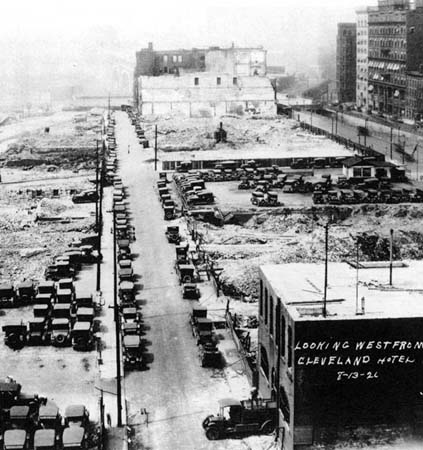
Looking west from Hotel Cleveland, August, 1926. The future site of part of the station after clearing but before excavation. Note streetcar slit in middle of Superior Avenue, leading to a lower level of the Detroit-Superior Bridge. CSU Archives. |
9. |
gamut55.jpg |
gamut55t.jpg |
| 13. |
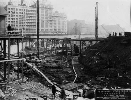
Future site of Higbee's Department Store,October, 1926, after partial excavation and construction of retaining walls along Ontario Street. Excavated material was hauled by train and truck to the west side and to the lakefront, where it was used as fill. CSU Archives. |
9. |
gamut56.jpg |
gamut56t.jpg |
| 14. |
Stones for the portico on Public Square came pre-cut from the quarry and had only to be assembled. |
9. |
gamut57a.jpg |
gam57at.jpg |
| 15. |
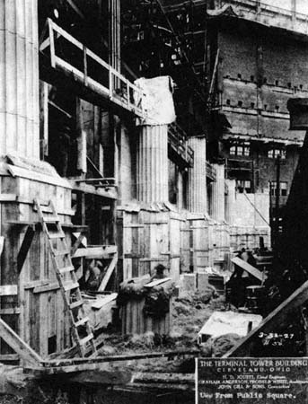
The sides of Public Square converging on the portico had to be graded downward towards the entrance. Note how much of the site had to be excavated. CSU Archives. |
9. |
gamut57b.jpg |
gam57bt.jpg |
| 16. |
On August 18, 1927, a flag flies atop the completed steel skeletal frame to celebrate the steelworkers' achievement. |
9. |
gamut58a.jpg |
gam58at.jpg |
| 17. |
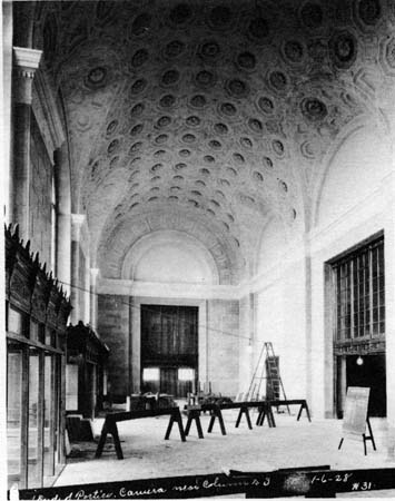
Interior view of portico, under construction in January, 1928. It was imperative to finish this entrance so the tower could be opened to tenants. CSU Archives. |
9. |
gamut58b.jpg |
gamut58bt.jpg |